


Description
Garmin 010-02367-02 12″ GPSMAP 1223xsv Advanced Chartplotter / Sonar Combo
Charts and Maps: Worldwide basemap: Non-detailed map for general reference.
Sonar Type:
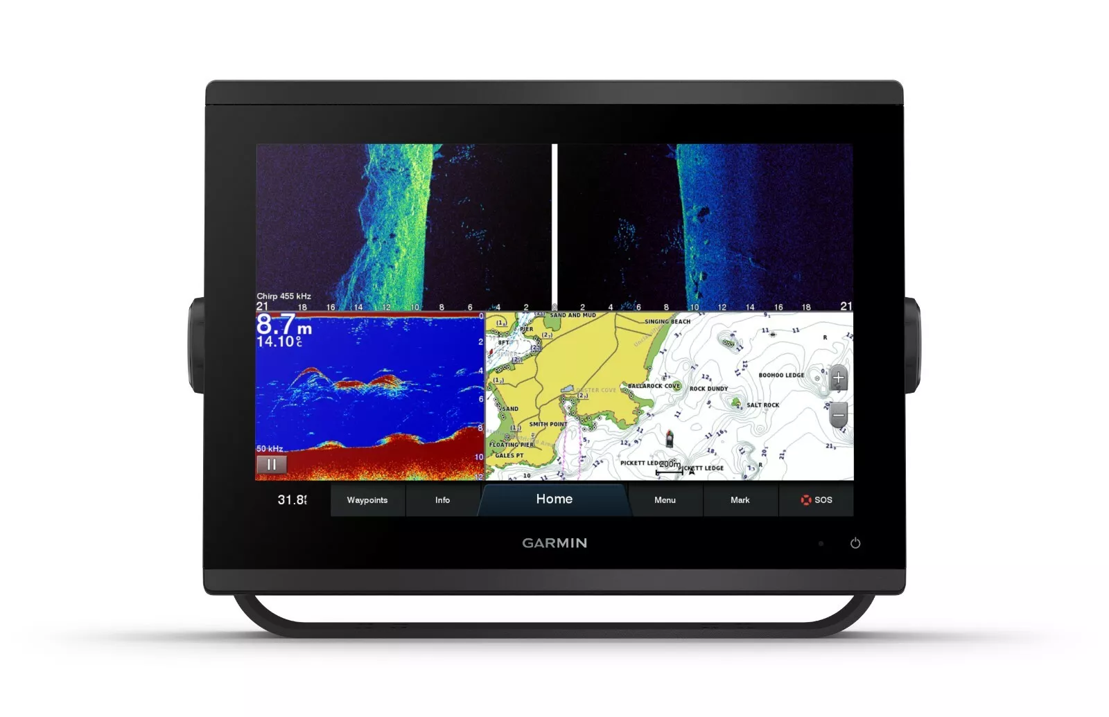
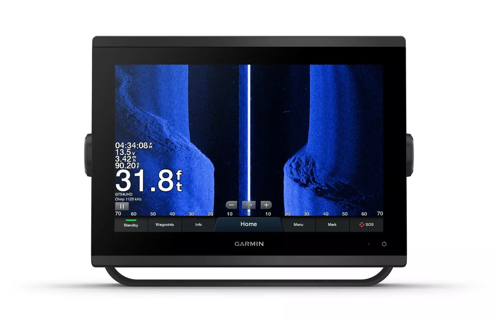
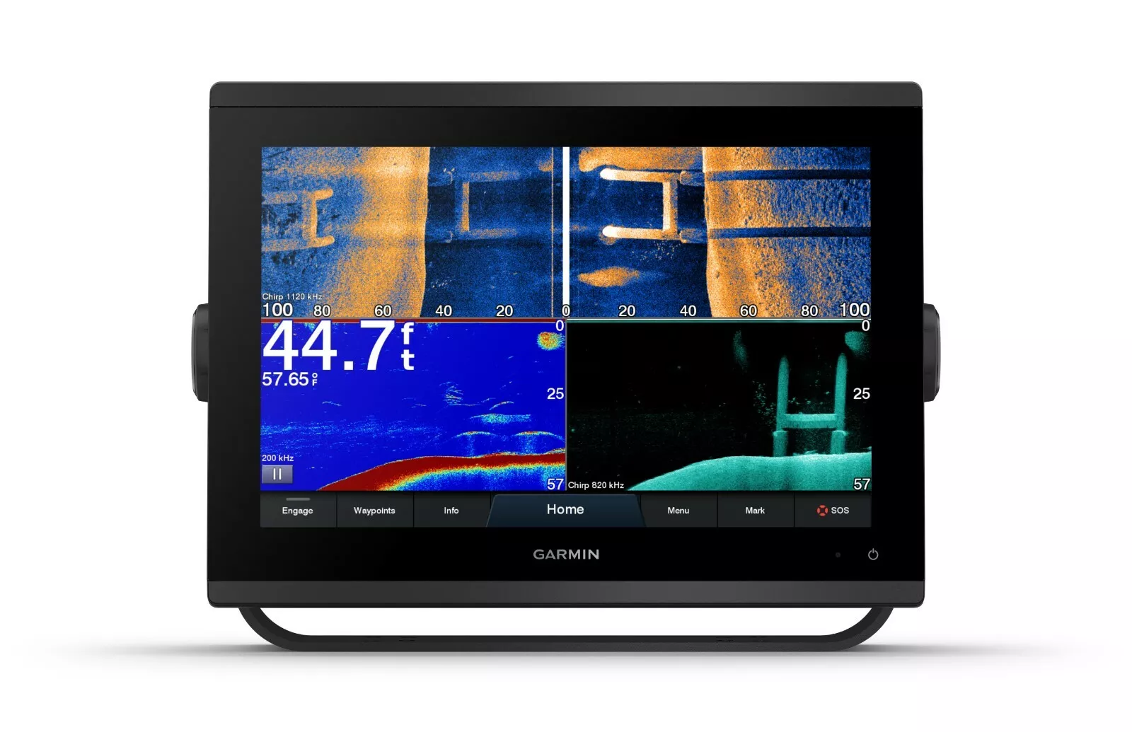
Traditional CHIRP: Good for displaying fish arches.
ClearVü: Excellent for displaying fish and structure below your boat.
SideVü: Excellent for displaying fish and structure to the sides of your boat.
GET A SHARPER VIEW FROM YOUR CONNECTED HELM
With its sleek design, powerful processing and upgraded IPS display, this advanced 12” chartplotter/sonar combo integrates seamlessly into your Garmin marine system.
Easily integrate with more engines.
Connect to compatible third-party devices with OneHelm™ digital switching.
Easily build your marine system using the best of network connectivity.
Navigate any waters with preloaded mapping and coastal charts.
See below your boat with built-in sonar capabilities.
Manage your marine experience from nearly anywhere1.
ULTRA HIGH-DEFINITION SCANNING SONAR
Get built-in Ultra High-Definition SideVü and ClearVü scanning sonars with vivid, high-contrast color palettes to help distinguish fish from structure. GPSMAP 1223xsv also supports 1 kW CHIRP traditional sonar capabilities.
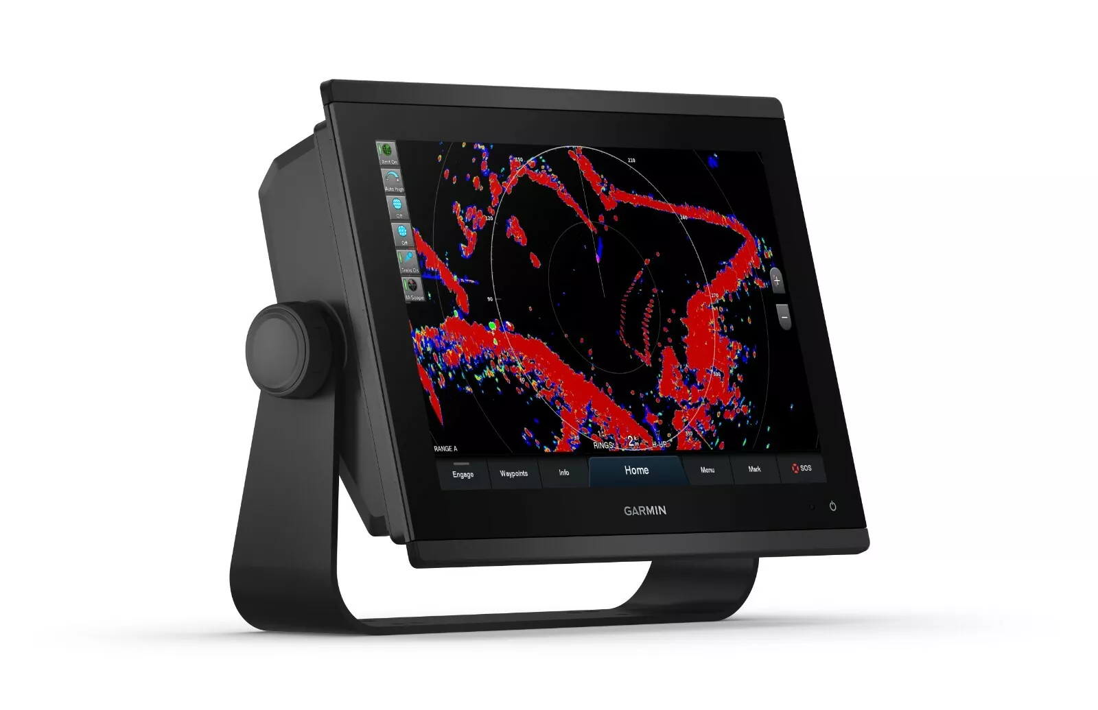
PANOPTIX™ SONAR SUPPORT
Pair with Panoptix or Panoptix LiveScope™ easy-to-interpret live sonar (transducer sold separately) to see all around your boat in real time.
FAST, SHARP, SMART
With its ultrasleek design, vivid sonar color palette and high-resolution 12” in-plane switching display, this large format chartplotter/sonar combo offers improved sunlight readability and wide-angle visibility.
OPTIONAL BLUECHART® G3 VISION® CHARTS
These optional charts offer the best of Garmin and Navionics® data, Auto Guidance3 technology and other premium navigation features.
GARMIN MARINE NETWORK
If you have multiple compatible Garmin devices on your boat, you can share information — such as maps, user data, radar and IP camera video — among them.
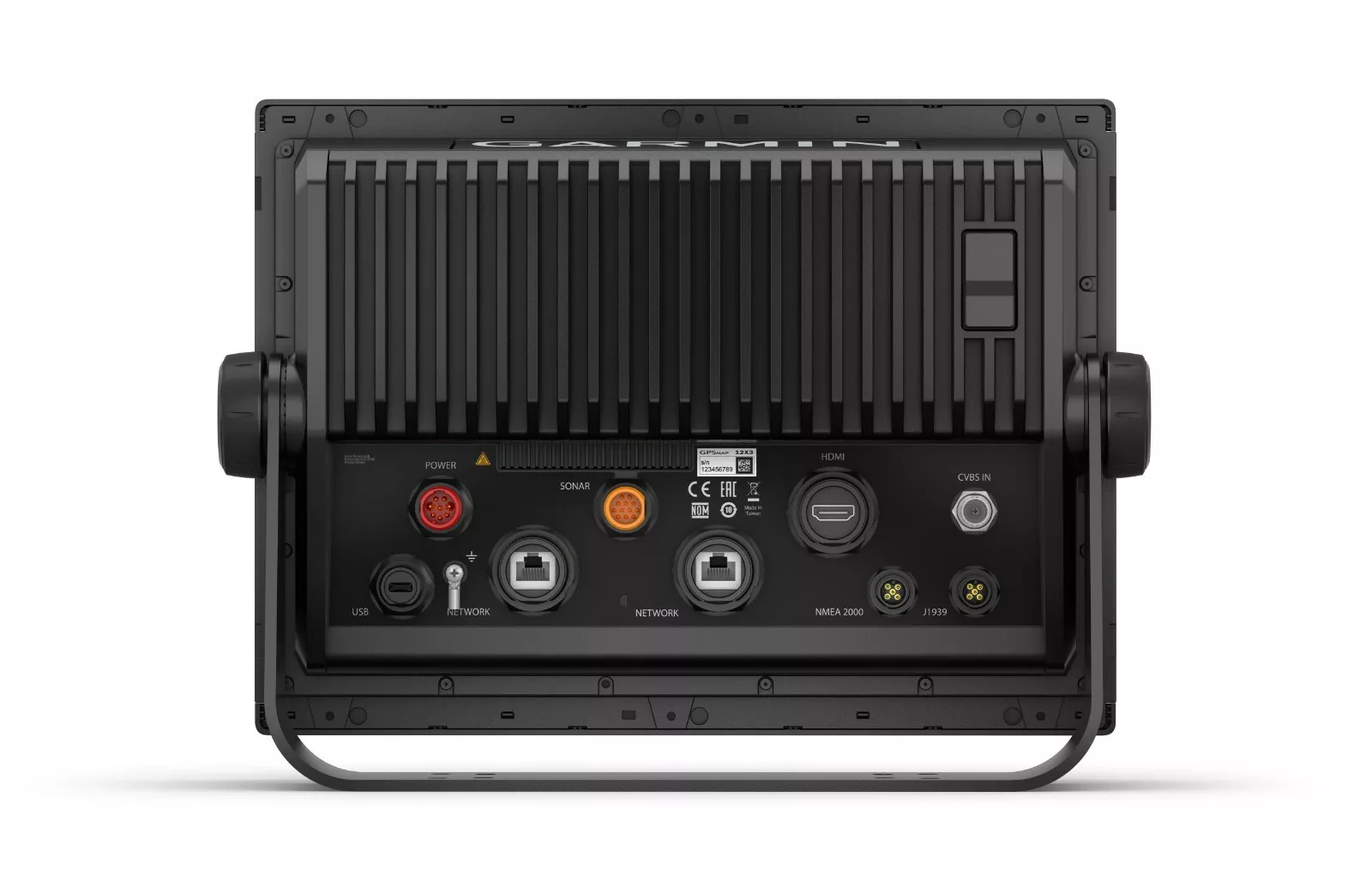
NMEA 2000® AND NMEA 0183 NETWORKS
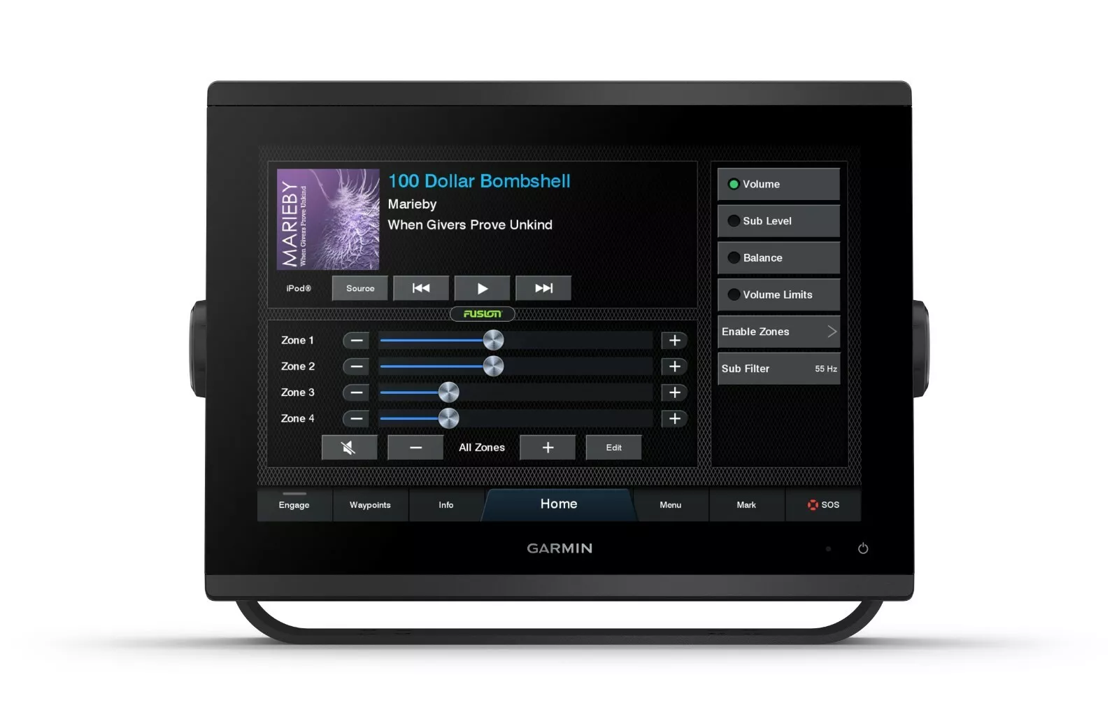
Connect to compatible autopilots, digital switching, weather, Fusion-Link™ audio system, media, VHF, AIS and more from one screen.
ACTIVECAPTAIN® APP
Built-in Wi-Fi® connectivity pairs with the free all-in-one mobile app for access to the OneChart™ feature, smart notifications, software updates, Garmin Helm™ digital switching, Garmin Quickdraw™ Community data and more4.
INTEGRATED ANT® TECHNOLOGY
Connect with some of your favorite devices, such as quatix® marine watches, gWind™ Wireless 2 transducers, GNX™ Wind marine instruments and wireless remote controls.
ENGINE CONNECTIVITY
Connect this chartplotter to different kinds of engines — including select Mercury and Yamaha® models — to see RPMs, fuel flow, temperature, trim and other important information at a glance. You may need additional hardware, so be sure to check with your engine manufacturer.
ONEHELM FEATURE
This exclusive feature brings together all the operations and capabilities of select third-party devices, such as EmpirBus™ digital switching, on one screen.
General
PHYSICAL DIMENSIONS 12.1” x 8.9” x 3.2” (30.8 x 22.8 x 8.2 cm)
DISPLAY SIZE
10.3″ x 6.4″; 12.1″ diagonal
(26.2 x 16.3 cm; 30.7 cm diagonal)
DISPLAY RESOLUTION 1280 x 800 pixels
DISPLAY TYPE WXGA IPS display
WEIGHT 6.6 lbs. (3.0 kg)
WATER RATING IPX7
MOUNTING OPTIONS Bail or flush
POLARIZED SUPPORT YES
POWER CONSUMPTION
Max power usage at 10 Vdc: 26.5 W
Typical current draw at 12 Vdc: 1.7 A
Max current draw at 12 Vdc: 2.2 A
ANTENNA Internal or external over NMEA 2000
TRANSMIT POWER 1 kW traditional; 1 kW CHIRP
RECEIVER 10 Hz high-sensitivity
GARMIN MARINE NETWORK™ PORTS 2
Reviews
There are no reviews yet.